Geographical enquiry
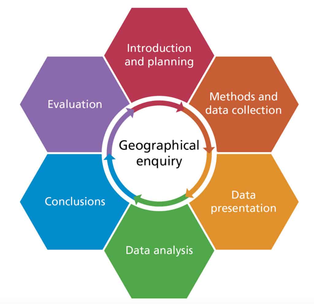
Geographical enquiry involves:
- asking a geographical question
- gathering relevant evidence (quantitative and/or qualitative) to answer the question
- presenting and analysing the evidence, which may include statistical analysis of numerical data although this is not essential
- drawing conclusions: creating a geographical argument to interpret the evidence
- evaluating your methods and conclusions
Aims
A statement of what you are trying to find out. In Geography there are broadly two kinds of aims:
Are things different from each other?
e.g. ‘Why does the rate of coastal erosion vary between different parts of Holderness?’
Are things associated with each other?
e.g. ‘Is there a link between deprivation and clone towns in north Suffolk?’
Hypothesis
An idea or explanation that can be tested through study and experimentation. A well written hypothesis is clear, directional and measurable.
e.g. ‘There is an inverse relationship between the index of multiple deprivation and the clone town index in north Suffolk.’
Asking geographical questions
Each section of this website includes prompts to think about geographical questions. Here are some examples
High energy coasts
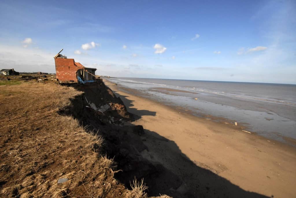
- What coastal processes are happening here?
- Is there a link between beach width and cliff height?
- What is the threshold event for cliff collapse?
Upland glaciation
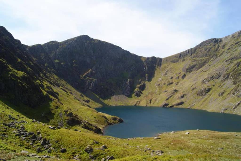
- What volume of ice did this corrie once hold?
- How much of what you can see is a relict landform and how much is still active?
- Why is the lake not a perfect circle?
Placemaking
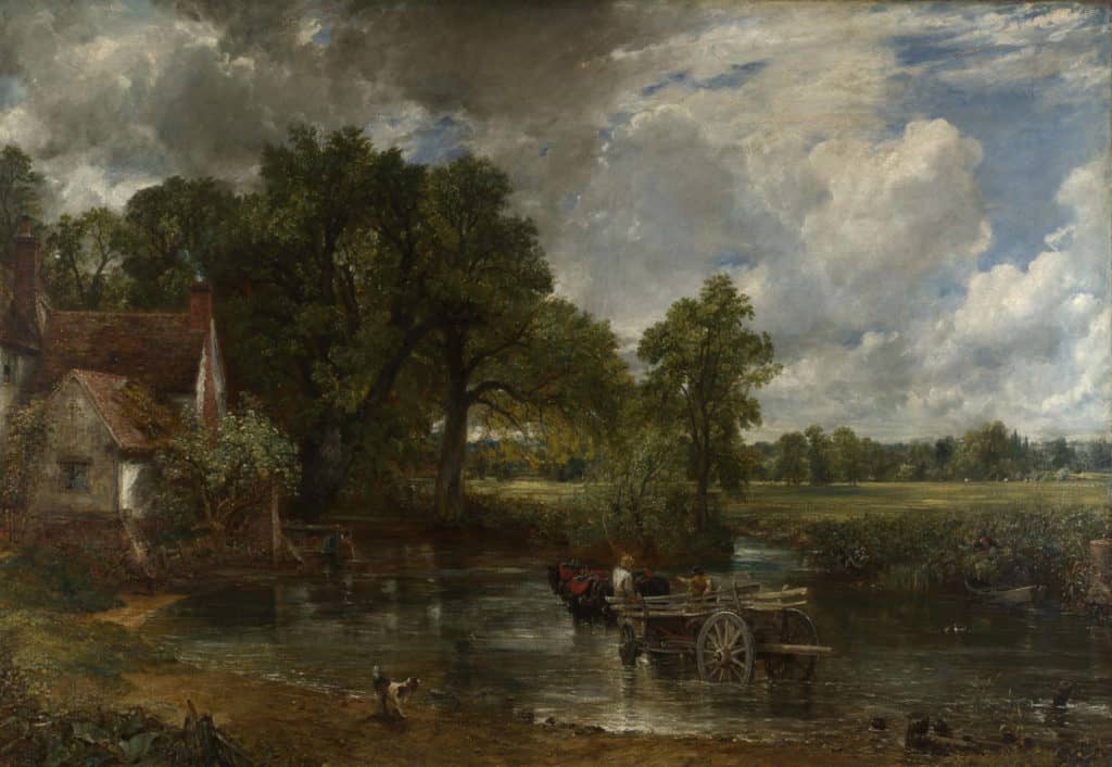
- How has John Constable represented the place of East Bergholt?
- Is it an accurate representation?
- How is this place linked to other places?
A geographical investigation involves the gathering of primary and secondary data, which may be qualitative or quantitative.
Data and evidence
Data
A set of values, recorded and interpreted to produce information.
Evidence
Facts and information used as the grounds for belief or disbelief.
Primary data
Data you have collected yourself, such as pebble measurements, questionnaire responses and sensory maps.
Secondary data
Data collected by someone other than yourself. It includes published data (such as census results and records of rainfall), historical data (such as old photos) and data collected by other students.
Quantitative data
Data that records quantities (e.g. numbers, sizes or frequencies).
Qualitative data
Data that records subjective qualities (e.g. opinions, attitudes and beliefs).
Types of fieldwork
This website takes the enquiry approach to help you structure your independent investigation. But here are other valid approaches to fieldwork. It is also possible to incorporate elements of these other approaches into a geographical enquiry.
Hypothesis testing
Use geographical theory to generate hypotheses. Test each hypothesis by collecting appropriate field data, then analyse data using statistical tests.
Discovery fieldwork
Explore a place for yourself by making observations, taking photographs or collecting objects. Consider urban drifting, where you take a structured but unplanned journey through a city.
Discovery fieldwork includes ethnographic techniques such as participant observation.
Places can also be explored using creative writing, images and film. Here the evidence can be interpreted by iconological content analysis, image analysis and coding.
Sensory fieldwork
Explore a place by sense of smell, touch, sight, hearing or taste. You can deprive other senses, perhaps with a blindfold, to heighten awareness of the target sense.
Possible strategies include sound mapping, back-to-back field sketching, aroma mapping and emotional mapping.

Secondary and Further Education Courses
Set your students up for success with our secondary school trips and courses. Offering excellent first hand experiences for your students, all linked to the curriculum.
Group Leader and Teacher Training
Centre-based and digital courses for teachers